Great Basin Interview is a study of petroglyphs and pictographs that date back to the early inhabitants of the Great Basin - a basin and range landscape that extends from the Sierra Nevada Mountains in the west to the Rocky Mountains in the east, and from Idaho to Arizona in the north and south. Pictographs are painted onto rock surfaces, and petroglyphs are carved into rock surfaces, exposing the lighter-colored rock that lies beneath the outer, darker patina. My fascination with these rock drawings has led me into the California deserts, across Utah, Arizona, New Mexico and into Southern Mexico in a search of a better understanding of these varied forms of rock drawings. I find that the glyphs unveil their mysteries to me slowly and surely. When I look at the petroglyph panels new aspects of my consciousness awaken. They teach me about environment, craft, food, ritual storytelling and time itself.
01/2018
Oaxaca, Mexico
Monte Alban
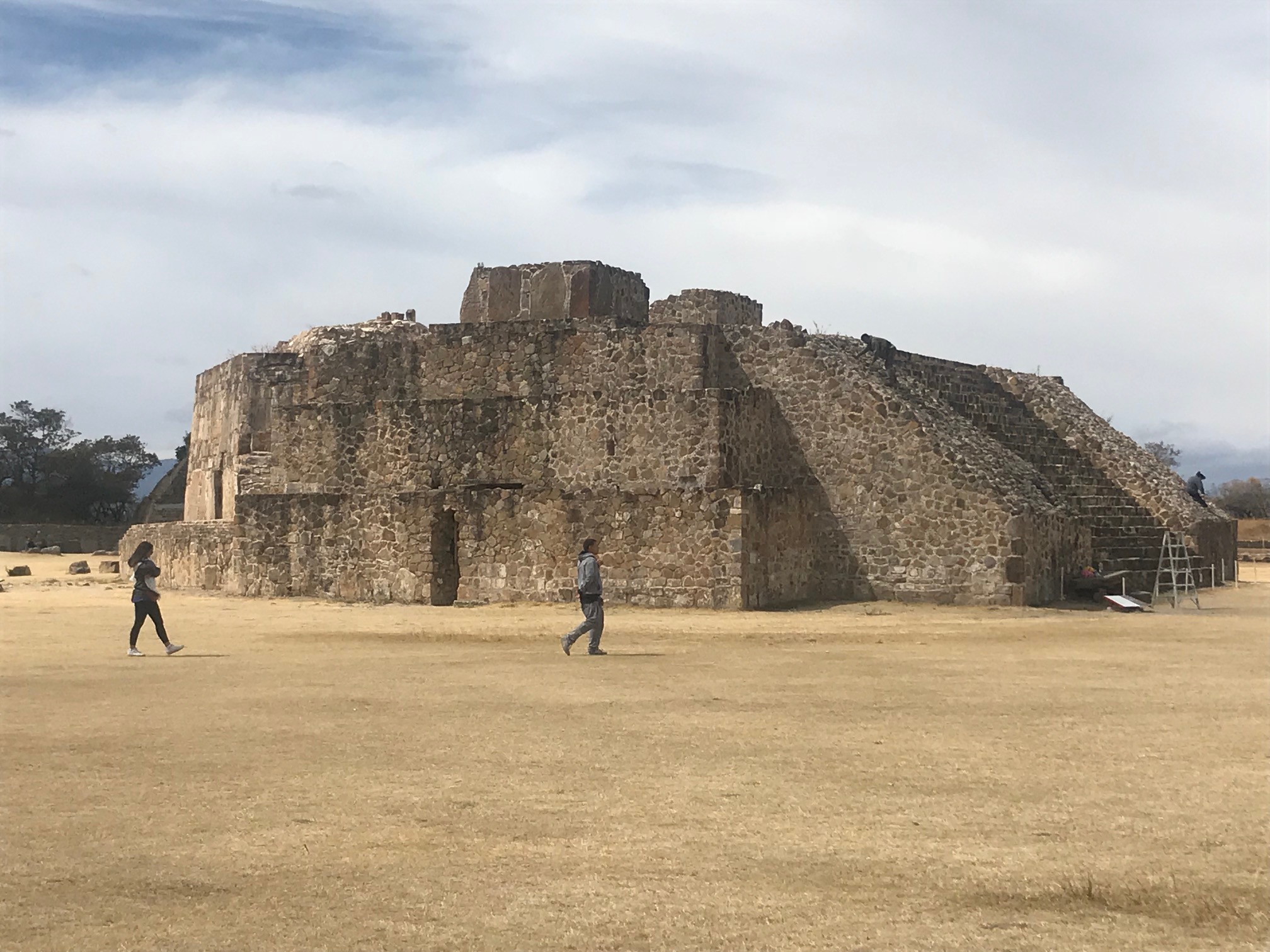
I recently visited the two archeological sites outside of Oaxaca, Mexico. Mitla, the religious capital of the Zapotec civilization, and Monte Alban--the political capital. The ruins of these ancient cities are equally breathtaking, but for different reasons.
At Monte Alban, sitting high on the north platform that overlooks the entire Oaxaca basin I ducked out of a whipping wind and took shelter against a 1,500 year old rock wall. Feeling the warm sun on my face I sunk into the kind of reverie, kind of like the “Choose your own adventure books” I remember from childhood—My favorite was the one about the Mayan pyramids. I found myself comparing the two ancient cities which had once bustled like Oaxaca City does today. Monte Albone must have been full of the sounds, smells and colorful sights that Oaxaca holds today. All of the fruit and vegetable stands, meats, tacos, textiles, sculptures, tools and trinkets could easily be transported back in time to the Zapotec city. But s series of questions burned into my mind. These two ancient cities had fundamentally different characters, and their architectures embodied this.
My mind reached 3,000 miles away towards the Great Basin deserts of California, Nevada and Utah. How does traveling to these sites in Mexico inform my understanding of the Great Basin? My instinct tells me that there is a clear connection, but my mind is clouded by overlapping objectives. Looking out onto the cascading plazas below I understood why Michael Heizer felt the need to build City. Although I have never seen it, I imagine it to be structured like these ancient plazas, a kind of futuristic Monte Alban and a modern ruin.
What purpose does an already abandoned city serve? How does spirituality manifest in architecture differently than politics? How does a ruin inform us? It is as pregnant with information as it is with mystery. What is the use of such an abandoned place? What is an afterlife? What kind of existence beyond life does it contain?
I was here because I was following the course of Anni and Joseph Albers across Mexico. To put it simply, the Albers’ saw into the shapes and lines of these architectures and textiles. They understood negative spaces in new ways precisely from looking at these ancient pyramids, plazas, tombs, but also through the living craft and culture of Mexico. I knew that I too would find something here too and this is why I came.
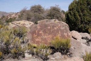
Have North Americans been looking to Mexico for millennia? At Chaco there is a petroglyph of a macaw at one of the Southern posts. The Anasazi and the Zaoptecs had advanced systems for reading the stars. Surely they shared their knowledge and understanding of the heavens. Did the knowledge and skilled labor that built Chaco originate in Mesoamerica? If so, then who made the long voyages from North to South?
Driving by Yagul, a cave dwelling site near Mitla that dates back 80,000 years I gaze out at a giant petroglyph overlooking the highway. I long to get out of the van and trek over to the labyrinth of interconnected caves that span these hillsides, but am on a tour, and not feeling all that well. I remember the guide at the botanical garden telling us that there are seeds of corn, beans, potatoes and chili found in these caves date back to the first known agriculture in the Americas--and quite possibly the world.
Mitla
When we arrive at Mitla we pass through town, along the skinny cobblestone streets. It is Sunday and the whole town is watching at a basketball game played inside a pavilion. A few tattooed youngsters sit outside a tienda looking bored. They eye the tour bus as we pass through. You can see the new town that is built on the older pyramids.
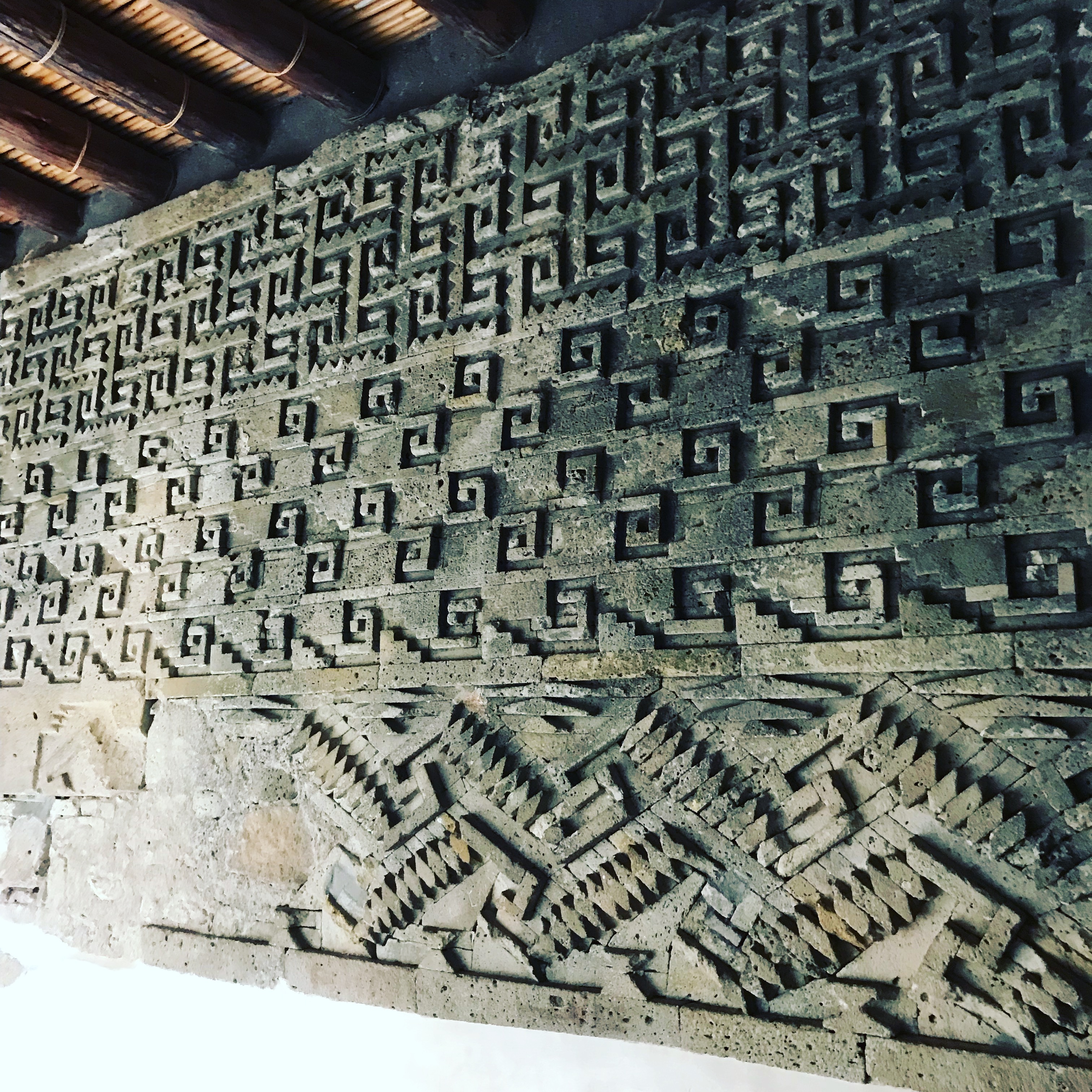
Mitla has been occupied continuously since ancient times. Arriving at the archeological site, it is modest in scale, but the masonry is out of this world--literally. The cloud people who are buried there are said to enter the clouds from that portal. There are many friezes that overhang the high rectangular rock walled structures. Each one is different with geometric patterning that folds back in on itself in masterful positive and negative relief. There is no mortar between the stones. They are perfectly cut and placed, together like a perfect puzzle. I am transfixed on the friezes—and kept trying to quickly draw one after the other before we had to move on and let another group into the tight little rooms designed for people half our size.
At Monte Alban I thought about the differences between the two capital cities, one political and the other spiritual. Monte Alban has vistas and grandeur. Mitla has intimacy and a sense of infinity that came from the interlocking patterning of the cut and layered stones. At Mitla there is geometric art. At Monte Alban there are steals with carvings of the human form. There are no human renderings at Mitla. Monte Alban has giant plazas, width and height and vantage points. It has a great astronomical pyramid that was angled at a diagonal to all of the other buildings in the great plaza -- but no human life. Mitla, let’s call it the spiritual center, has continuity, organized abstraction. Each has virtue and a particular character. If only I could stay longer…
At Monte Alban I make sure to skip the tour. I sit and draw all day, missing the bus home at the end of the day. I have to hitchhike home. This is a pinnacle moment in my life, a momentous day where grandeur and intimacy coexist together, at least in my mind, neither cancels out the other but slowly reveals architectonic mysteries that connect me to the Great Basin petroglyphs in the North America desert so far away.
03/2016
Geoglyphs
Blythe, CA
Outside of Blythe, CA there are geoglyphs that I have read about but never seen. Both Ellen Meloy and Barry Lopez wrote about them in such a way that I felt like a fool not to exit whenever I passed Blythe on I 10. The trick seemed to go there upon leaving California, at the onset of a journey. And since I didn’t leave the city until 3pm, by nightfall I was at the edge of Blythe. I decided to check in at the Red Roof Inn and go looking for the glyphs in the morning.
At dawn I woke up, made a cup of black tea, stumbled into my truck and went looking for the site with only a vague notion about where it was. The clerk at the motel (who had never actually been to the glyphs) gave me directions that seemed simple enough the night before. By the time I had driven few miles outside of the city limits, past the green pastures that the Colorado river provided for this otherwise dry desert center, I was heading North and had not checked by odometer. Ruefully aware of my lack of survival skills, it suddenly hit me that I ought to be paying closer attention to what I was doing. The desert can make you delirious, see things, lose your bearing…Very quickly I found myself on the edge of the Mojave.
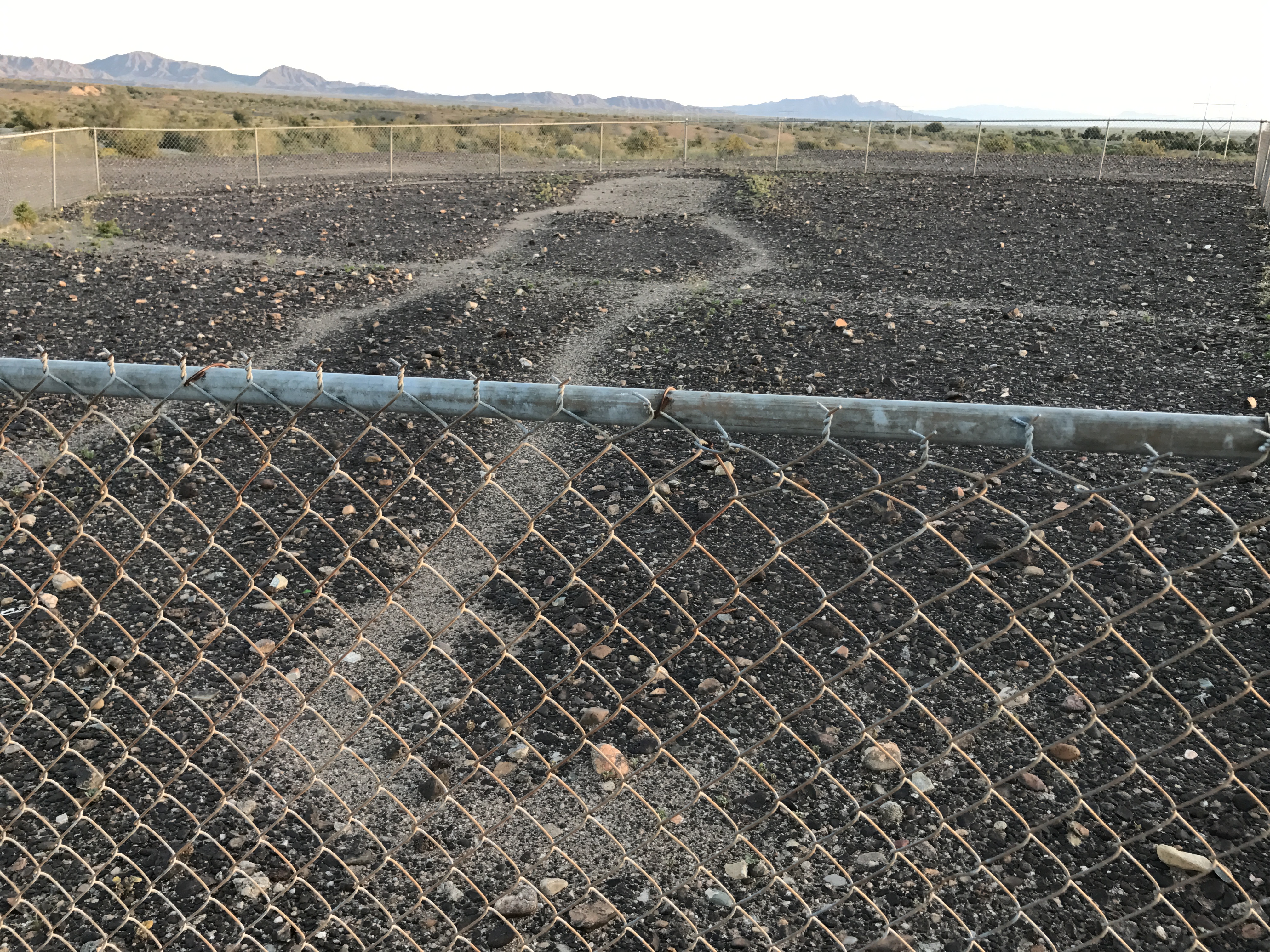
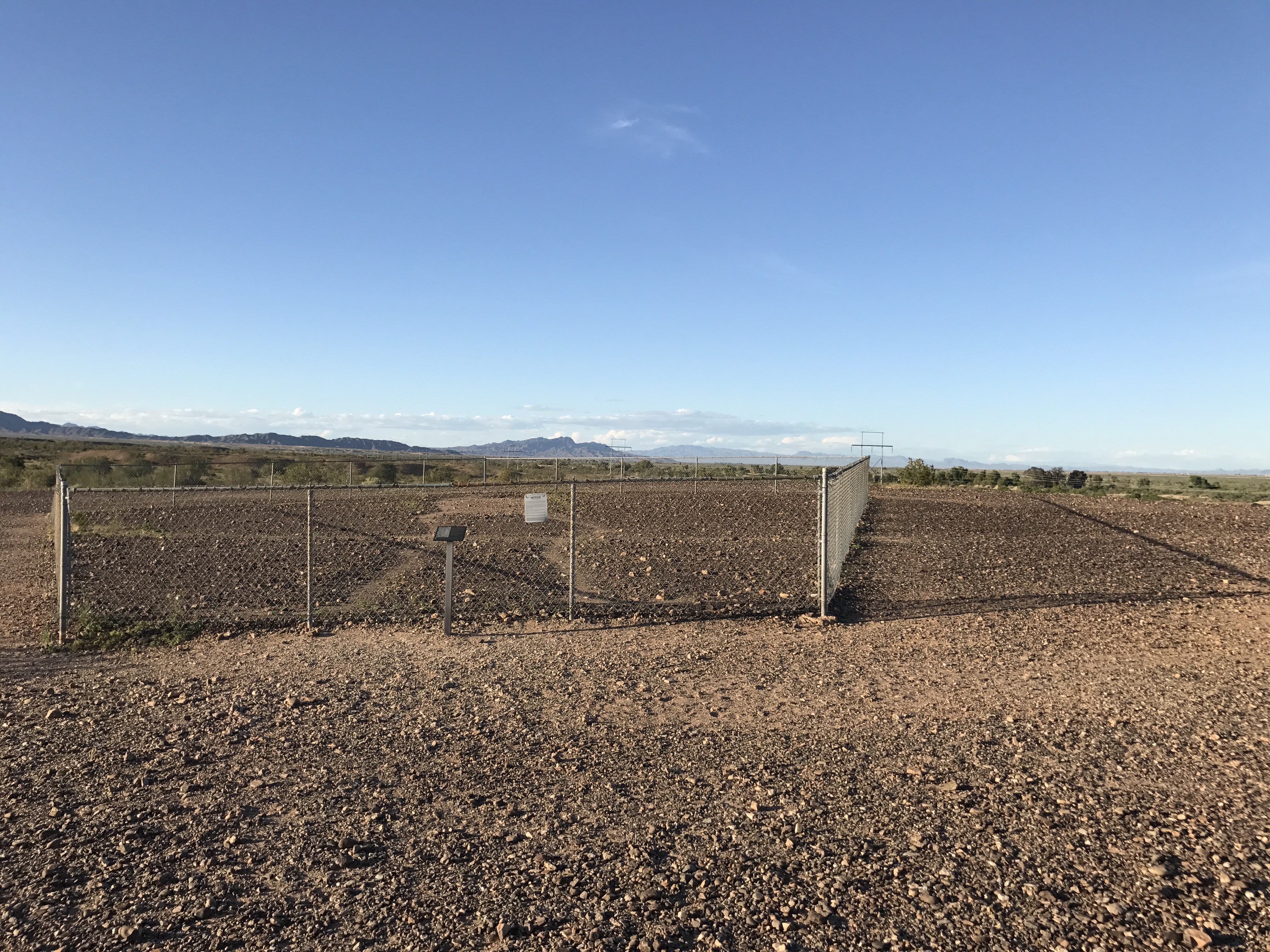
Geoglyphs, or intaglios, are different than petroglyphs. They are carved onto the face of the Earth, from the horizontal pebble-scape instead of on a perpendicular rock face. As I crept along the road and the sun started to rise I felt a rush of fear course through my veins--just a few miles out of town. I wanted a sign that I was heading in the right direction. I was suddenly aware of how little I think about where I am going these days. I just follow my GPS blindly around Los Angeles. I was mostly alone on the road, except for a single semi that was pulled off on the slim shoulder. I did not detect hostility as the root of my fear, but rather a dull feeling of being far away from others, of being close to the limits of what I understand. The feeling plays tricks on my ambitions. Opposing desires began to battle within me. I could return to my hotel room where is it dark and cool and known and get back on the highway heading for Gallup, or push further along this road and seek the unknown.
I have not brought any sort of map, nor thought to program this location into my phone, but I glanced down at a post card of the glyphs that I bought last night in the motel lobby. On the card it said that the glyphs were 15 miles North of Blythe. Surely I had driven at least this far. I turned my truck around and headed back towards a bend in the road that looked like there was a turn off. As I pulled a u-turn in the middle of the highway I saw the mile marker, 14 miles to Blythe. I immediately knew that I had not gone far enough. So I pulled around again, passing the trucker parked on the side of the road for a third time. I waved sheepishly. Sure enough there was a historical marker and BLM land sign just past where I had been before and I caught a glimpse of the Colorado River. It was almost 7:30 AM now and I could feel the heat of the day rising with the sun.
My friend Leslie Ryan says, “The desert is like a museum.” And there is a sense of preservation here, a sense of stasis. The BLM sign welcomes me at the same time it warns me against driving off the road or disturbing the landscape in any way. There is a wooden fence that funnels me through a somewhat lunar terrain. The sun pierces my eyes, and rests on my shoulders. I forget my hat on the seat of the truck. I don’t wear sunscreen. I blindly stumble up to a chain link fence and gaze across the low “relief” of intaglio scraped from the desert floor.
The light is gold and brown. The ground is corrugated and parched, covered with pebbles. The shadows of the fence posts are long and bend away from the low relief of the glyphs. They are crisp and black and they fascinate me. The shadows makes a kind of hypercube shape on the ground and counter the 95 ft. span of intaglio, measuring it, clocking it. Like a veil, the shadow of the chain link gently covers the round pebbles. Without form or substance, light perseveres or it is blocked. I feel as if I’ve walked into another dimension, a place where time is being marked. I am merely passing through and mistaken about my significance. Not so far from the road I hear a few more trucks passing. My thoughts wander to the contrast of man now and before.
The shadows of the posts project across the pebbly ground making their Cartesian mark over this older mysterious scape. These two inches of depth are enough to set an idea in motion, whatever needs to be set here. I sense it, but I do not understand it. The length if the glyph speaks to the length of the shadow of the fence, to the time of day, to the direction I am facing. But I am certainly turned around and barely know which direction I am headed. I am a spectator at this event, of this system. A few beetles make their morning trek for food in front of my shoe. Again I am compelled to leave and stay simultaneously. 'Man and coyote' is the glyph. I quickly decide this. I make up my own story as I travel up the BLM road to the other site. I stand in front of glyph of what looks like a woman to me. Creation myths are told here. I am standing beneath her crotch. Looking into the shape of my own body, into the mountains. I feel reborn.
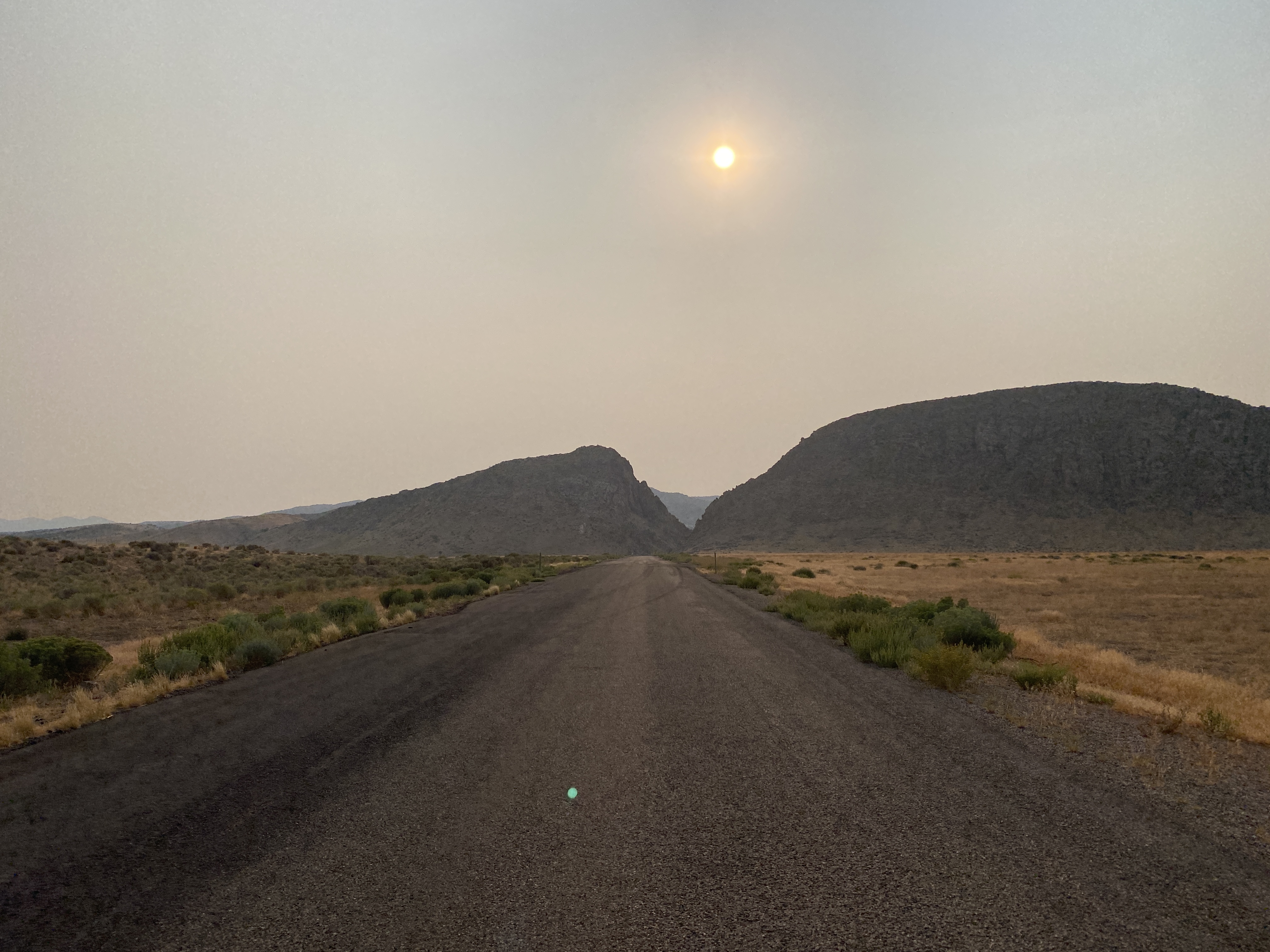
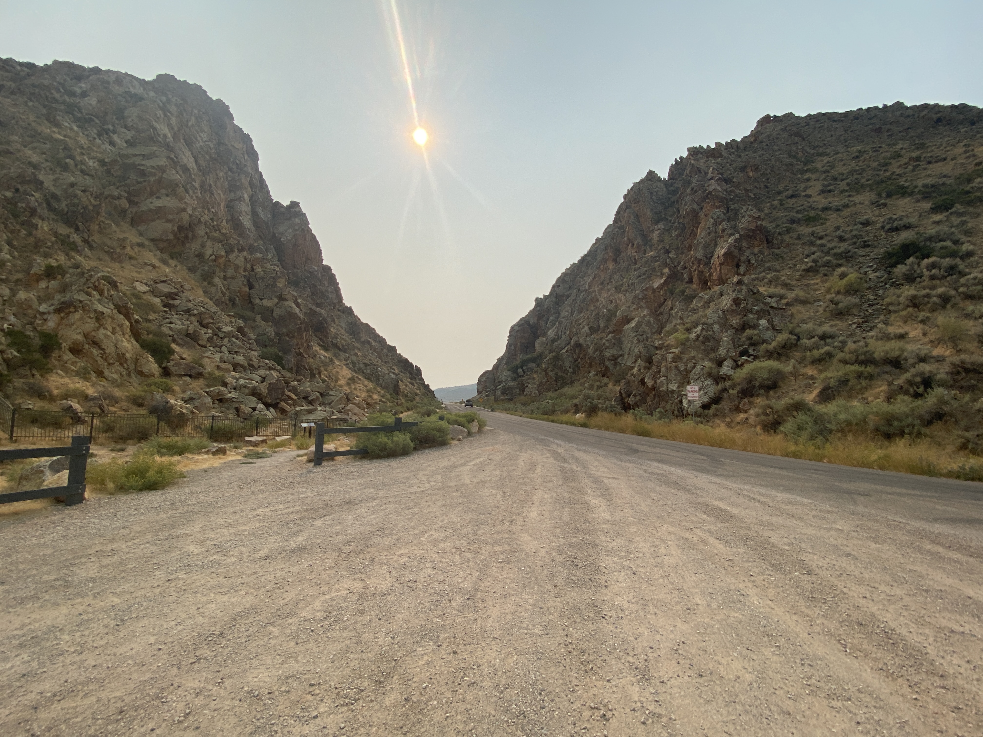
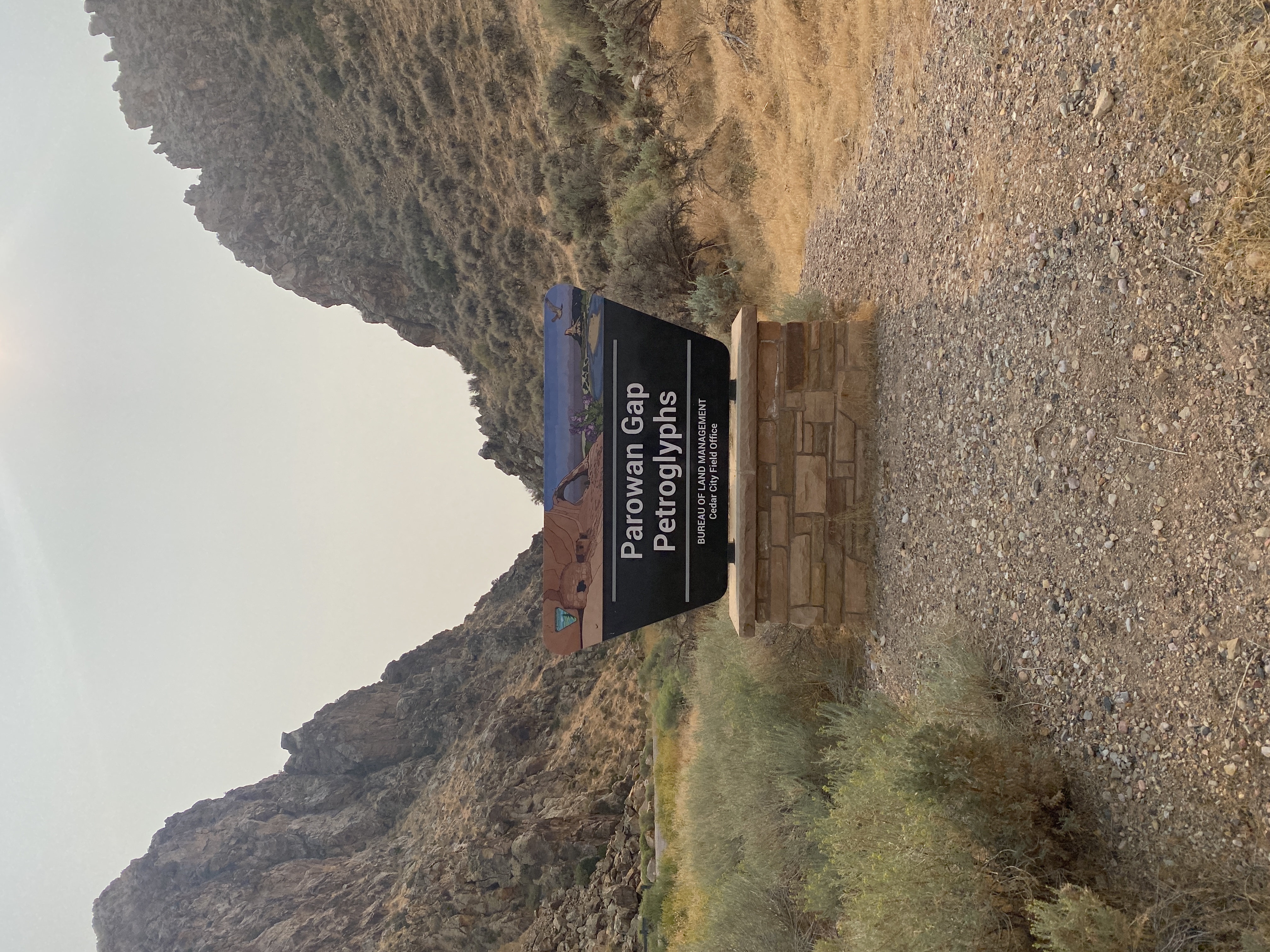
Parwan Gap, UT
Lake Mead, NV
I met my friend in a parking lot at the Las Vegas airport. She traveled from Virginia. I drove from Los Angeles on a warm Thursday morning. I was more than happy to put that 300 miles of Mojave between myself and the LA. And I was eager to ditch my truck in the parking lot and let her drive, right though the monstrosity of glittering gold casinos and giant billboards with airbrushed women's body parts that Vegas has to offer.
Even when we rolled up to our campsite at Lake Mead as the sun was setting I could still feel LA. Our little oasis campground had short fat palm trees and a nicely cultivated desert landscape feeling. It was also across from an abandoned trailer park. We laid a tarp on the gravel under a hedge and pulled the car up next to us to shield any oncoming car lights. We were pretty much alone but you never know who will drive up in the middle of the night. When I saw the dark sky open up and the stars come out I finally felt the shift from city to open-air desert, and I let out a sigh of relief. After our dinner of left-over sandwiches from whole foods, I lay down on the ground and glued my eyes to the stars above us -- and the vastness of outer space. I chatted with Leslie about our days leading up to that one and slowly dozed off.
One thing I love about Leslie is that she allows certain surreal things to be real. Most people seem to ignore or negate the intensely intuitive and phenomenological world of her perceptions.
Then suddenly, I was jolted awake by a low “Hee Hawing” sound. It sounded as if there was a herd of wild donkeys on the other side of the hedge. I didn’t know if they were warning us, or fighting amongst themselves. We both jumped up out our sleeping bags -- I was terrified, but then we both burst out laughing. We were laughing so loud that we scared the animals back from the hedge. When walked around camp to see where the hilarious hee hawing creatures had gone they just move back into the night. We settled back-back down ourselves, still howling in full guttural release. I suddenly felt very human and a little bad at the advantage we had over the other animals. But laughing felt so good I couldn’t stop. That laughter somehow marked that we were female. We staked our presence in the night.

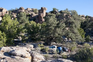
Mt. Irish Wilderness, Nevada
After sleeping on Bureau of Land Management land for a couple of days I’m starting to get a better feel for these remote public lands. We are free to sleep wherever we want, but it is full of cattle and an occasional off-road vehicle. Where we camped last night was fully was trampled down in cow and sheep prints. The plants were heavily clipped by think hungry cattle who wander around looking for something tender to eat. On these stark hillsides there is only pinion, bristle-cone pine and endless sagebrush.
We slept in the Pahraganat valley, camped on a little ridge about 200 feet from the petroglyph site, above the arroyo and rough 4wd road that went further into the canyon. He watched over us, funny fellow who is shaped like a peanut, sometimes with owl claws. There were many birds there. A meadowlark and a canyon wren, hummingbirds. When we left a red tailed hawk came out to say goodbye.
We met a crew of Utah Rock Art Association members in Alamo, at the Windmill cafe, which was pretty much the only place to eat in Alamo, except for maybe the Sinclair gas station. The Windmill turned out to be the place for information, food and coffee. It was a generous place with high A frame peak and barn-like ceilings. Service is slow, but the food is good and the staff is nice.
I keep turning over in my mind the same half formed questions about the petroglyphs, resolving nothing. My mind skates along my superficiality. I’m looking for cracks where an insight might spring forth. Never free from my presumptions, never concise, always within the shadow of doubt. Images, stories, feelings, temperatures, observations, afterthoughts and hints of conversations about the landscape scroll through my mind. Dreams in the night of animals. Is there any way to be reborn into a field of a new kind of information. My thoughts cannot be summed up, only be strewn around. They seem forever inchoate, like the embers of a fire left burning --- for centuries. I decide that I don’t need any answers, I am happy to keep looking, guessing, returning. I doze off into sleep laying against a rock while reading about spider woman and the Hopi creation myth. Maseo is going to the grandmother spider woman who knows all and tells him where to go into the underworld where the snake clan lives in the kiva. The book displays photos of the hillside where Spiderwoman lived. I read how the highway department destroyed her home in 1984 when they finished I 70. The glyphs on the hill were interpreted by Le van Martineau.
What is a petroglyph? What does it mean? What are they there for? Is it a script, a pictogram, a story? If so, what is the syntax? It is certainly different from a sentence. Can it tell a story faster? There are patterns repeated again and again in the Great Basin. The pictograms here are different from those in New Mexico. What are the prejudices I bring to them? What can I not see because I am so full of my own thoughts, expectations, desires and biases? How can I distance myself enough from my own culture in order to really see another on more equal terms?
Later, back at work in the lab at UCLA I feel as far away from the Earth as I could ever be, underground and surrounded by scientific apparatus. Is the scientific method a way to understand the glyphs, or is it better to forego understanding for a different kind of knowledge. Do glyphs not speak like rocks, primarily through intuition?

10/22/12
Reno, NV
The weather shifted today. There is a winter storm circling Reno, and big dark clouds hover over the mountains in the direction of Donner Pass. Michele called in the evening to say they would not let anyone drive on the interstate heading West unless they had chains on their tires so she spent ½ the day getting chains... It is still sunny in Reno, only a few drops of rain. But the temperature dropped 20 degrees.
I decided to stay in the Eldorado hotel for another day or so to get my bearings while I plan my next move. It’s freezing outside! I spent much of the day driving around Reno and figuring out how to get to Lagomarsino Canyon where the petroglyphs are supposed to resemble textile and basket designs. Getting there seems to be a challenge.
When I called the Bureau of Land Management office in Carson City, they directed me to the Stillwater field office where I spoke to one archeologist who tried to discourage me from looking for petroglyphs all together. She said that they are very difficult to find, and that they are often small and corroded, or returned to the original color of the parent rock. When I brought up Whiskey Flats and the book by Robert Heizer, there was a long pause and she urged me to stick to well-marked locations. Later she said I would get more information from books than actually going on site. The guy at the tourist office in Virginia City told me to ride my mountain bike into the canyon, which sounded like more fun. Only when I finally found the canyon on a map and saw how long it would take I went to for the 4wd option.
I started looking for maps at the BLM office in Reno, which is located in the Reno flats, near the largest Whole Foods Market I have ever seen. There was also Sierra Trading Post, which had a big sale, and I picked up some long underwear and warm socks for the next days trek. The BLM sent me to the Desert Research institute, which is part of the University of Nevada and set on the side of a mountain. It was very windy up there but the sun was shining and I could see most of the breathtaking Reno valley.
Some very nice ladies there helped me to locate the canyon on the series of quadrangle topographic maps. Lagomarsino was in the far bottom right corner of a map printed in the 1960’s and is no longer marked on the new maps. This is common for historically significant archeological sites. They don’t encourage visitors. But one of the women had been to the canyon many years prior. She helped me xerox the maps and figure out the roads I needed to take to get there. They were long and windy and crisscrossed with other unmarked roads. They were patient and helpful but cautioned me that the roads were not maintained and in very bad condition, and insisted that my vehicle have very high clearance. After we had pretty much figured it out, one of the women agreed to be my "call person". I was supposed to call her when I got out of the canyon the next evening. This made me feel better about my insane looking plan to 4wd into the middle of nowhere with the storm looming in the mountains.
I drove down the hill to the University to check out a book dedicated to Lagomarsino by Alvin McLane. But by then, it was pretty late in the day and I didn’t have much patience left for more research. I went through a rigamarole in the library stacks anyhow and looked over McLane's paper and photographs to get a better sense of the landscape. Then I called the rental car place and was lucky to get the last 4x4 truck for the next day. It was freezing, I was exhausted and the sun was beginning to set. I went back to the hotel and caught the tail end of the Obama/Romney debate.
I like Reno. It is an interesting town. The architecture is mostly brick, but eclectic in style, English Baroque and Victorian. Frederick Delongchomp, started out as a mining engineer and designed most of the government buildings int he 1880's. A minerals town, they have a mining department at the University. Everybody wears car harts and boots, and drives a new truck. They are friendly. There were quite a few hitchhikers walking along the roads—young and old. I saw a few haggard looking veterans-coming down from the mountains to find shelter from the storm. There is something very wild about this place.
It was also becoming obvious to me that our modern roads overlaying the land here, go to different places than the Indian roads. One has to go deep into the hills to see these roads, and I am surprised they are still there, but there are many traces of the Paiutes, Shoshone and the Washoe and the Numa and Freemont’s before them. The towns: Virginia City, Reno, Dayton, Fallon etc. seem completely out of context to the petroglyph sites. (Note: read Lucy Lippard's “Overlay.”) The climate has changed, and a modern way of thinking and doing has changed the speed at which we move across the land. Nor do white people don’t think like Indians, our priorities are different. Lagomarsino was the summer camp for the Washoe people. But it is also Piute land... I am eager to walk off the beaten track, to get a sense of the land. Strong mountains — strong weather, the tension between the clouds and the mountains is palpable, and visible. I feel so alive! The air is unbelievable crisp. This is the storm that shifts the seasons--from hot dry fall to winter.
*Panel recording, (what Archeologists look for):
Aspect, orientation, presence of cracks and other irregularities, condition of the art, condition of the panel generally, (graffiti, mineral build-up), surrounding vegetation (this changes over time but it still seems relevant, especially for dyers) relationship to other glyphs, other proximities...
*Photo: far, middle close, with and w/o scale